We managed to leave Whangamomona without meeting anyone whilst we were there, not even the campsite owner!!
Our route took us on the other half of The Forgotten World Highway to Taumarunui. We stopped along the way and walked a short way to Mt Damper Falls, a loooooong drop but a magnificent waterfall. Other than another brief stop for lunch we continued driving right through to Taumarunui, we met a few cars and a very large herd of sheep on the road but otherwise it was very isolated.
 |
| Rolling farmland from the Forgotten World Highway |
 |
| Mt Damper Falls |
 |
| The Mt Damper Falls |
 |
| Just to prove we were there!! |
 |
| The Forgotten World's traffic jam but... |
 |
| ...there were more.... look how far the road goes round the hillside and the number of sheep on the road!!! |
 |
| ...AND MORE!!!!!! (see the sheep on the hillside road) |
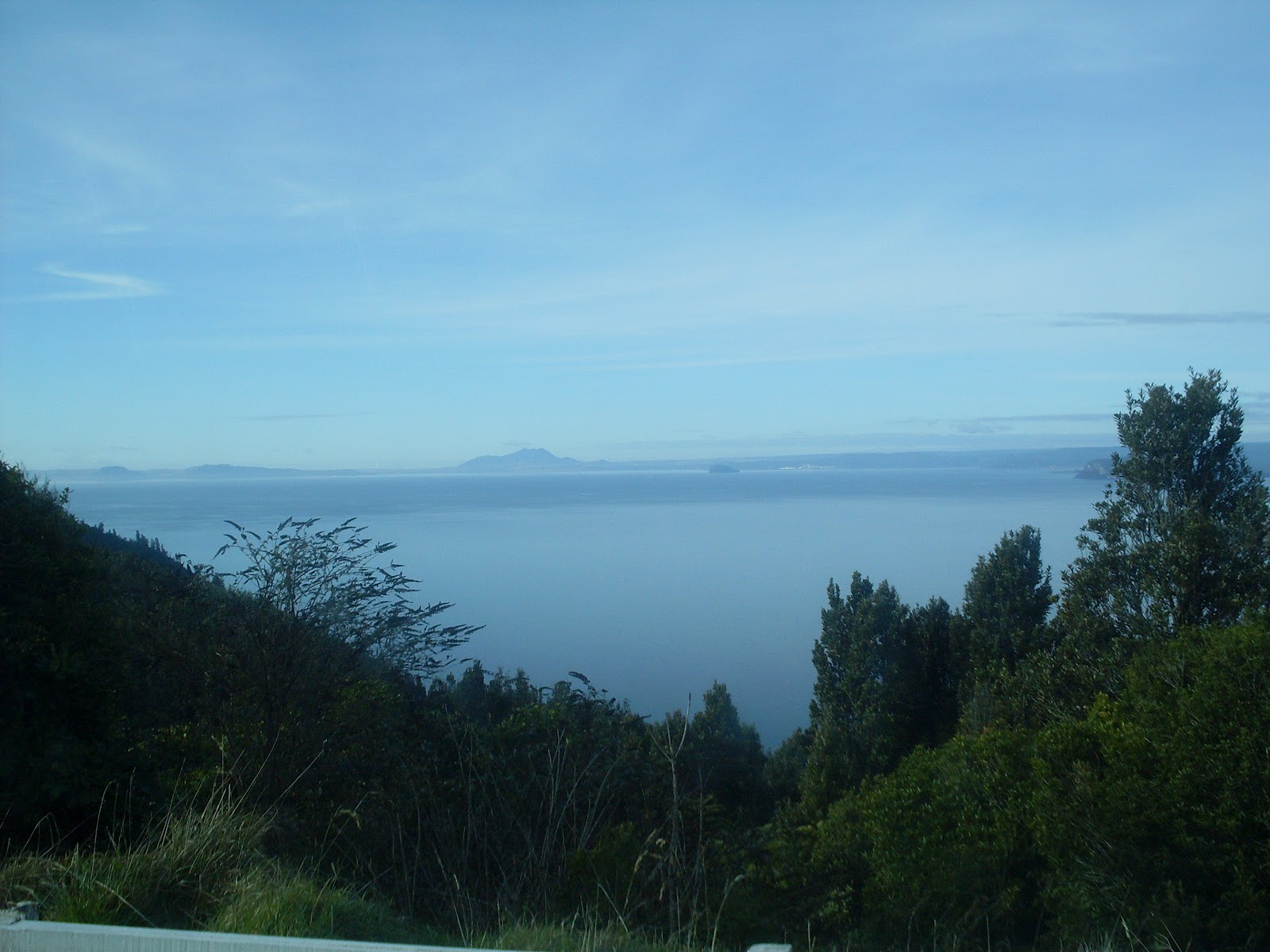
Once off The Forgotten World Highway we picked up the highway 41 to Turangi. The latter part of this road was besides the largest lake in New Zealand, Lake Taupo and made stunning views.
Lake Taupo was once an active volcano which last erupted in 186AD covering the whole of North Island with 24 cubic km of ash, rock and debris. The eruption was noted by both the Chinese and Romans. The lake now sits in what was the crater. It is still a lively geothermal area with lots of hot springs and boiling mud!!
 |
| First views of Lake Taupo |
 |
| Lake Taupo |
 |
| More of Lake Taupo |
 |
| Lake Taupo with beautiful misty mountains on the other side |
We briefly stopped in Turangi for refreshments and the carried into Taupo township, where we found a campsite next to a hot spring and enjoyed an evening soaking in the hot natural mineral waters :)


more sheep than sharneyford or rawtenstall roundabout!
ReplyDelete